
VILLAGE GUIDE
Adhelai Village
Outside Dholera SIR
References: Village Map, Dholera Draft Development Plan. Images are illustrative.
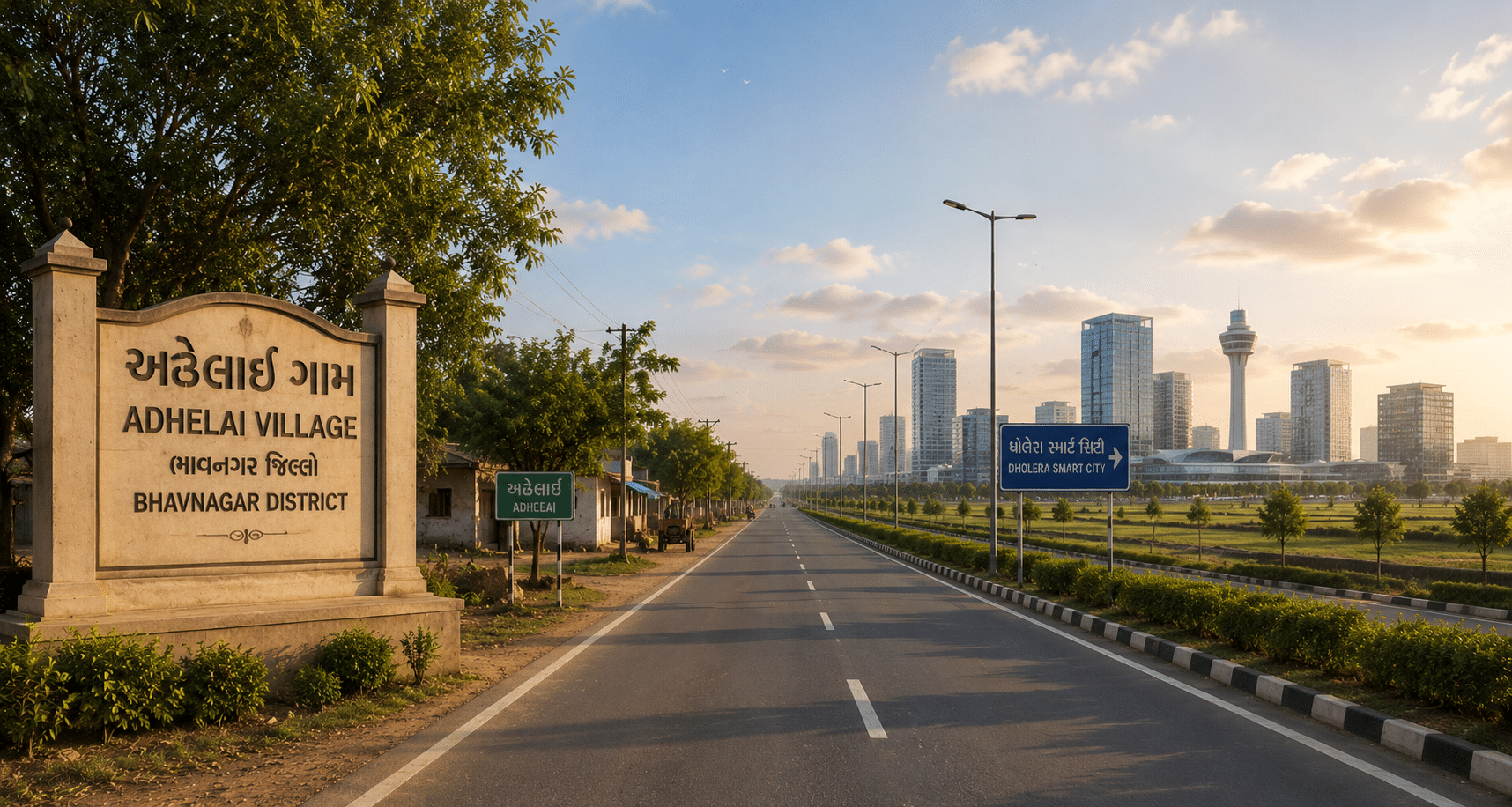
Table of Contents
✓ Suitable For
- Developers planning residential plotting projects
- Families planning a future home near Dholera
- Buyers who want SIR proximity without SIR planning restrictions
- Buyers who value direct expressway access
- First-time land buyers starting with a smaller budget
✕ Not Ideal For
- Buyers looking for ready-to-move homes
- Buyers who need a bank loan to complete the purchase
- Buyers planning to exit within one or two years
- Buyers unwilling to check revenue and environmental records before paying
- Large industries needing industrial-zoned land
About Adhelai
Adhelai is a revenue village in Bhavnagar taluka of Bhavnagar district, covering roughly 3,318 hectares. It falls outside the Dholera SIR, so land here is governed by the district and taluka revenue authorities rather than by DSIRDA.
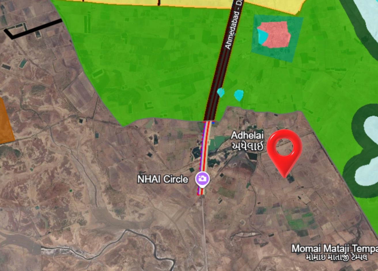
What sets Adhelai apart is the road. The Ahmedabad–Dholera Expressway — 109 km of four-lane, access-controlled highway running from Sarkhej through Dholera SIR — ends at the Adhelai Interchange, inside this village. It opened in March 2026. Very few villages in this belt can point to a piece of infrastructure of that scale sitting on their own revenue land.
The village boundary also runs alongside the Dholera SIR for roughly 10.5 km, measured from the DSIRDA Draft Development Plan map. Both agricultural land and converted non-agricultural land trade here, and Adhelai carries its own non-agricultural ward in the city survey records.
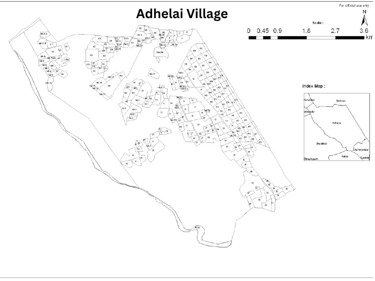
Village Map (Survey / Revenue Map)
Land & Ownership Types
Buying Land Outside Dholera SIR
Buying land outside the SIR follows the ordinary Gujarat revenue process, not DSIRDA’s planning system. Land is purchased on the open market through a registered sale deed, and any conversion or development permission comes from the district and taluka authorities.
For Adhelai, that means Bhavnagar. The 7/12 extract, 8A and mutation entries come from the Bhavnagar taluka e-Dhara office, and the cadastral village map from the District Inspector of Land Records, Bhavnagar. Where a parcel has already been converted, the record sits with the City Survey Office — Adhelai has its own non-agricultural ward there.
One thing worth knowing before you commit: agricultural land in Gujarat carries buyer eligibility conditions, and whether they apply to you depends on your own status. Confirm this before paying any advance, not after.
- Clear Title & Documents
- Revenue Record Verification
- NA Conversion (if required)
- Registration at Sub-Registrar Office
Adhelai & Dholera SIR
Adhelai’s boundary touches the Dholera SIR directly. Measured against the DSIRDA Draft Development Plan map, the two share roughly 10.5 kilometres of boundary — the third longest contact among all villages along the SIR’s edge.
That does not mean SIR rules apply here. The boundary is exactly where DSIRDA’s jurisdiction stops. Land inside carries zoning, FAR limits and TP scheme obligations; land in Adhelai does not. What the adjacency does affect is what gets built next door — and with the expressway terminating in the village, Adhelai is the point where traffic entering and leaving the region passes through.
Distance Overview
- Dholera SIR boundaryShares boundary
- Adhelai Interchange (Expressway)In the village
- Velavadar Blackbuck National Park~9 km
- Bhavnagar~45 km
- Ahmedabad (via Expressway)~109 km
Why People Buy Here
Risks & Considerations
- Being outside the SIR means no DSIRDA planning protection or guaranteed infrastructure timeline
- Recorded road access must be verified on the cadastral map – proximity to the interchange does not by itself give a parcel legal approach access
- Adhelai sits in the wider Velavadar Blackbuck landscape – confirm environmental and Eco-Sensitive Zone status for your survey number with the Bhavnagar Forest Department
- Agricultural land carries buyer eligibility conditions under Gujarat law
- Land close to a new interchange can be priced ahead of actual development on the ground
Indicative Pricing
Why the difference? Plot rates include NA conversion, internal roads, demarcation and the smaller ticket size. Bulk land is the same land before that work is done.
Price depends on location, road access, connectivity, amenities and several other factors. Indicative as of August 2026. Contact us for current pricing.
Available in Adhelai
Explore land parcels and plots currently available here.
Frequently Asked Questions
Is Adhelai inside Dholera SIR?
Where does the Ahmedabad-Dholera Expressway end?
How far is Adhelai from Ahmedabad?
Can I buy NA land in Adhelai?
Where do I check land records for Adhelai?
What documents should I verify before buying here?
Primary References
Dholera SIR Draft Development Plan — DSIRDA · Ahmedabad–Dholera Expressway (NH-751) — NHAI · Revenue records and cadastral village map — District Inspector of Land Records, Bhavnagar · Official land valuation — Gujarat Revenue Department e-Jantri · Survey-number cadastral map — Bhu Naksha, Gujarat Land Records
Our experts are here to help you make the right decision.
Explore verified land & plot listings in Adhelai.
Use this checklist before finalising any purchase.
Information on this page is compiled from publicly available government documents and other verified sources. Please verify all details with the relevant authority. Read Full Disclaimer →
Own land in Adhelai?
DholeraProp deals in land here. If you are considering selling, talk to us about current demand and a fair valuation.