
VILLAGE GUIDE
Mingalpur Village
Inside Dholera SIR
Last Reviewed: August 2026
·
References: Village Map, Dholera Draft Development Plan. Images are illustrative.
Table of Contents
✓ Suitable For
- Buyers looking specifically at recreation or tourism-zoned land
- Buyers working to a lower entry point than the villages nearer the developed phase
- Buyers willing to run a forest-status check before committing
- Buyers comfortable with a parcel whose timeline depends on a single scheme
- Buyers taking a long view on parts of the SIR still at draft plan stage
✕ Not Ideal For
- Residential plot buyers – no residential-zoned land is offered here
- Industrial buyers – no industrial-zoned land is offered here
- Buyers who want exposure to more than one scheme's progress – Mingalpur depends on TP6 alone
- Buyers who cannot check forest and revenue records before purchase
- Buyers expecting roads, water and power already delivered to the plot edge
About Mingalpur
Mingalpur is a village inside Dholera SIR, in Dholera taluka of Ahmedabad district, covering roughly 33.08 square kilometres. Its recorded population was 2,133 at the 2001 Census, the figure the Draft Development Plan works from (DSIRDA Draft Development Plan, Appendix C, Table C-1).
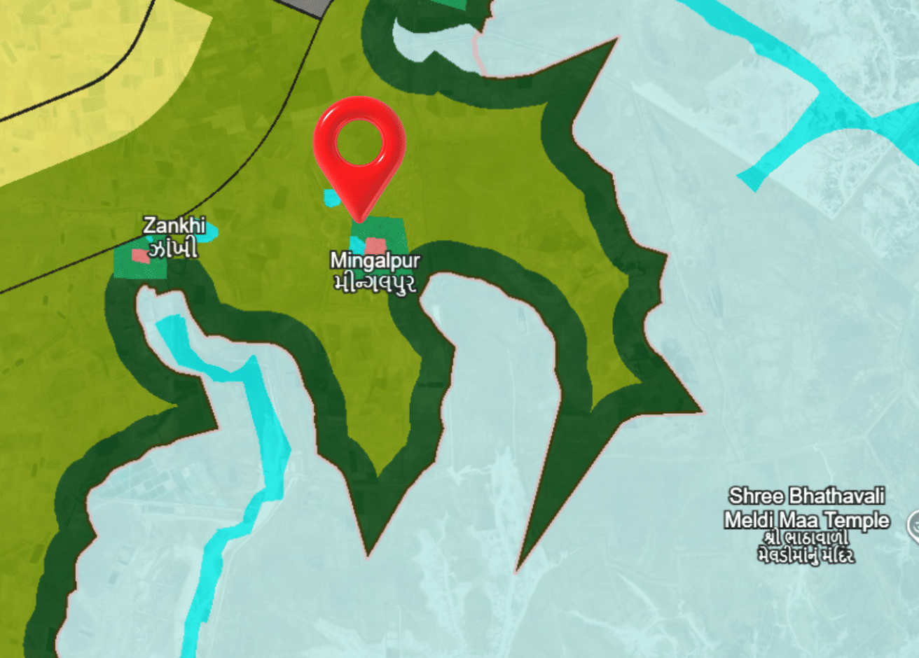
One thing makes Mingalpur structurally different from every other village in the SIR. All of its land sits in a single Town Planning Scheme – TP6, alongside Zankhi, Bavliyari, Bhangadh and Hebatpur. Every other village of the 22 appears in the part-village list of two or three schemes. Mingalpur appears in one. For a buyer that is worth understanding rather than glossing over: there is a single scheme’s progress to follow here, and no second timeline behind it.
The other thing to check before buying is forest. The Development Plan’s forest schedule lists seven survey numbers in Mingalpur as notified forest under a 1975 Gazette entry – 184, 185, 186, 187, 190, 191 and 202 – totalling roughly 190 hectares, with survey number 202 alone accounting for about 165 of those (Appendix I, Table I-1).
What trades here is recreation and tourism-zoned land, at the lowest indicative band of the villages we cover. No residential or industrial parcels are offered in this village. Mingalpur sits outside the Activation Area.
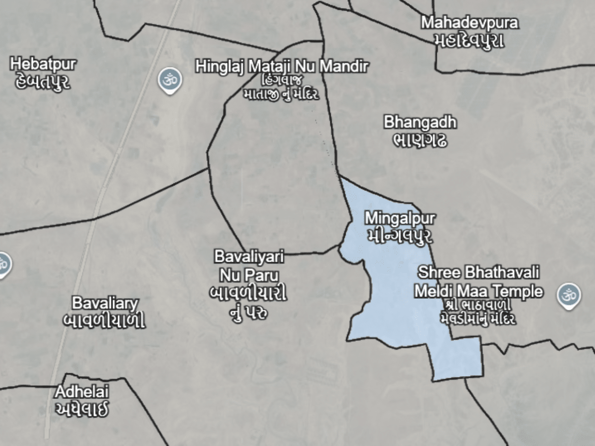
Village Map (Survey / Revenue Map)
TP Scheme & Land Status
Buying Land Inside Dholera SIR
Two checks matter more here than the usual ones. First, the forest schedule: compare the parcel’s survey number against 184, 185, 186, 187, 190, 191 and 202, the numbers listed as notified forest in the Development Plan’s Appendix I. Forest-notified land is not ordinary agricultural land and cannot be treated as such.
Second, the scheme stage. Because all of Mingalpur’s land sits in TP6 alone, that scheme’s progress is the whole story for a parcel here. Ask which TP6 sub-scheme the plot falls in, what stage that sub-scheme has reached, and ask to see it on the sanctioned drawing rather than on a marketing sheet. If a seller names a different scheme for a Mingalpur parcel, that contradicts the TP6 drawing and needs explaining before you go further.
Then the zone: only recreation and tourism-zoned land is offered here, so if a parcel is being described as residential or industrial, check the zone under the Draft Development Plan first.
Then the usual: the 7/12 and 8-A entries, the Final Plot (FP) number, the DSIRDA NOC and confirmation of NA clearance. A survey number on its own tells you where the land is, not what stage it has reached.
For the land record itself, use AnyROR, the Gujarat Revenue Department portal at anyror.gujarat.gov.in. Select Ahmedabad district, then Dholera taluka, then Mingalpur — village code 065.
- Confirm TP Scheme & Stage
- Verify Final Plot (FP) Number
- Check DSIRDA NOC
- Confirm NA Clearance Status
Mingalpur Within Dholera SIR
Mingalpur’s land sits in Town Planning Scheme 6. The TP6 draft scheme drawing names it in the part-village list, together with Zankhi, Bavliyari, Bhangadh and Hebatpur – five villages in all.
What makes Mingalpur unusual is that this is its only scheme. Every other village inside the SIR contributes land to two or three schemes; Bhangadh and Zankhi are also in TP4, Bavliyari is also in TP5, Hebatpur is in both. Mingalpur is in TP6 and nothing else. A parcel here therefore rises and falls with one scheme rather than several.
Which villages belong to TP6 is settled by that drawing. How much of the scheme comes from Mingalpur land is not – we hold no verified percentage breakdown for TP6, and we are not going to estimate one. Membership is confirmed; share is not.
One caveat on the source. The TP6 drawing in our records is dated 2014, while the TP1 to TP5 drawings are dated 2025. The part-village list on it is legible and unambiguous, but it is an older document, and a later version may exist. Confirm against dholera.gujarat.gov.in before treating anything here as final.
Mingalpur sits outside the Activation Area, which covers the TP-2A and TP-4A scheme areas.
Distance Overview
- Activation Areaoutside
- Ahmedabad~120 km
Why People Buy Here
Risks & Considerations
- About 190 hectares of Mingalpur land is recorded as notified forest under a 1975 Gazette entry carried in the Development Plan's own schedule – forest-notified land is not ordinary agricultural land, and any parcel here should be checked against that schedule before purchase
- All of Mingalpur's land sits in a single scheme, TP6. That cuts both ways: there is only one scheme's progress to follow, but a parcel here has no exposure to any other scheme's timeline if TP6 moves slowly
- The TP6 scheme drawing carried in our records is dated 2014, while the TP1 to TP5 drawings are dated 2025 – confirm against dholera.gujarat.gov.in that no later version of the TP6 scheme has been published
- No residential or industrial land is offered here, so anyone shown "residential plots in Mingalpur" should check the zone under the Draft Development Plan first
- All six Town Planning Schemes covering the SIR are drafts, and the Development Plan and GDCR carry "Draft" in their titles too – zone boundaries and regulations can still change
Indicative Pricing
Indicative as of August 2026. Rates vary within each zone by TP scheme stage, road access and Final Plot status. Contact us for current pricing.
Available in Mingalpur
Explore land parcels and plots currently available here.
Frequently Asked Questions
Which TP scheme is Mingalpur in?
Is there forest land in Mingalpur?
Is Mingalpur inside Dholera SIR?
What is the land price in Mingalpur?
Is Mingalpur in the Activation Area?
How big is Mingalpur?
Primary References
Dholera SIR Draft Development Plan — DSIRDA · Draft Development Plan, Appendix I, Table I-1 — forest area details · Draft Development Plan, Appendix C, Table C-1 — village population · Draft Town Planning Scheme 6 drawing — DSIRDA · Village directory — Census of India 2011 · dholera.gujarat.gov.in
Our experts are here to help you make the right decision.
Explore verified land & plot listings in Mingalpur.
Use this checklist before finalising any purchase.
Information on this page is compiled from publicly available government documents and other verified sources. Please verify all details with the relevant authority. Read Full Disclaimer →
Own land in Mingalpur?
DholeraProp deals in land here. If you are considering selling, talk to us about current demand and a fair valuation.