
VILLAGE GUIDE
Shela Village
Outside Dholera SIR
References: Village Map, Dholera Draft Development Plan. Images are illustrative.
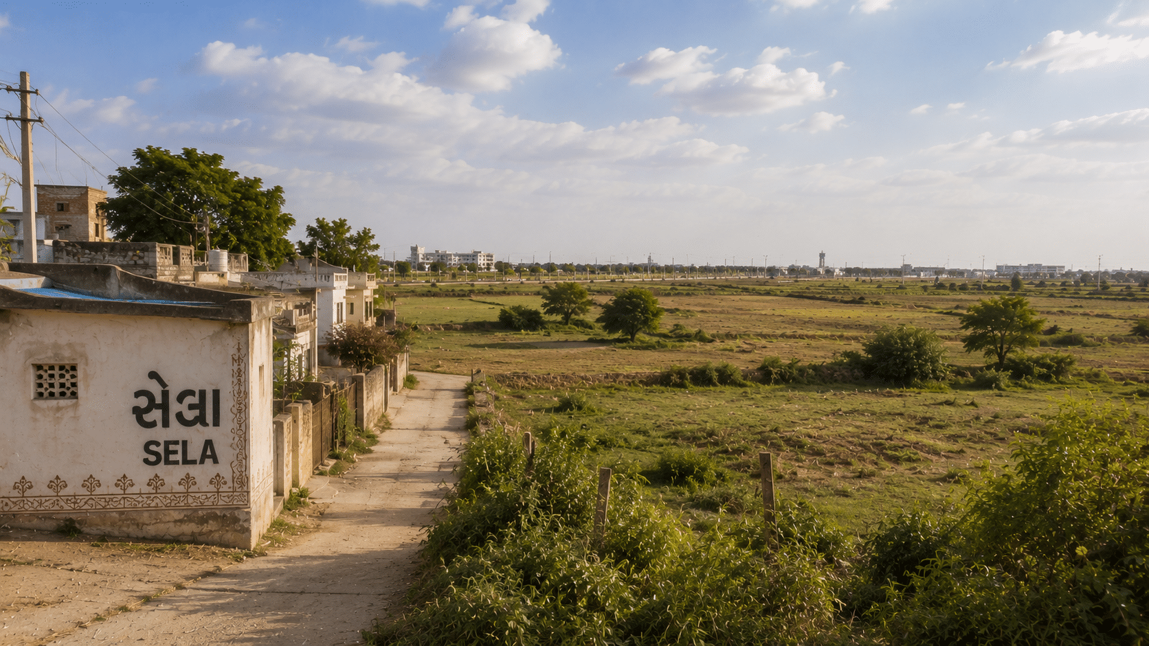
Table of Contents
✓ Suitable For
- Buyers who want land physically touching the SIR boundary
- Smaller agricultural parcels rather than large blocks
- Buyers already comparing Gamph, Valinda and Kamatalav
- Long-horizon holders comfortable with an undeveloped area
- Buyers willing to handle their own NA conversion
✕ Not Ideal For
- Anyone looking for the Shela near Bopal in Ahmedabad city
- Buyers wanting very large contiguous blocks in one village
- Anyone who needs to start building soon
- Buyers expecting DSIRDA-planned roads, water and power
- Anyone who wants land inside the notified SIR
About Shela
Before anything else, the disambiguation, because this one causes real confusion. There is a Shela in Ahmedabad West — a built-up residential locality near Bopal and South Bopal, full of apartment projects, sitting off the Sarkhej–Sanand road. This page is not about that Shela. This page is about Shela village, census code 511906, a farming village of about 594 hectares roughly 105 km south of the city, on the edge of Dholera SIR. The two share a name and nothing else. If you are searching online, listings for “Shela, Ahmedabad” will almost always be the city locality.
Shela village sits in Dholera taluka, Ahmedabad district. If a seller’s paperwork says Dhandhuka, that isn’t necessarily an error — Dholera taluka was created out of villages of Dhandhuka and Dholka talukas, and Census 2011 still lists Shela under Dhandhuka. Current revenue records sit under Dholera. The DSIRDA plan map adds a third variation, spelling the village SELA.
At about 594 hectares Shela is the smallest village on the adjoining list — smaller than Kasindra, and a fraction of neighbours like Gamph (4,131 ha) or Kharad (4,766 ha). Census 2011 counted 1,515 people in 256 households. That small footprint is the thing worth understanding here: with roughly 5.75 km of measured frontage on the SIR boundary, a large share of the village sits along the line rather than a few kilometres back from it.
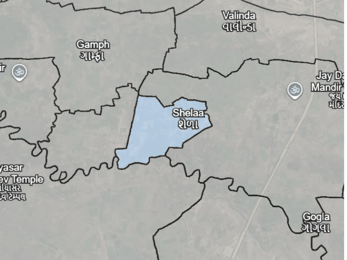
It also sits in the middle of the northern boundary cluster. Gamph, Valinda, Kamatalav and Kasindra are all immediate neighbours, which is why buyers comparing this belt usually end up looking at several of these villages in one trip rather than one in isolation.
Village Map (Survey / Revenue Map)
Land & Ownership Types
Buying Land Outside Dholera SIR
Shela’s land records are held under Dholera taluka, Ahmedabad district. Pull the 7/12 and 8-A extracts from the e-Dhara kendra at the Dholera taluka office, and take any measurement or survey-number query to the DILR office, Ahmedabad. Older extracts, and some seller paperwork, will show Dhandhuka taluka — that reflects the position before Dholera taluka was created and isn’t a defect in the record, but always pull a fresh copy under Dholera taluka before you pay anything. Confirm which sub-registrar office currently has jurisdiction over Dholera taluka before you fix a registration date.
One extra check applies to Shela specifically. Because a well-known Ahmedabad locality shares the name, and because the plan map spells it SELA, match documents on the census code 511906 rather than on the village name. A listing, a brochure or a search result that says “Shela, Ahmedabad” is far more likely to be the city locality than this village.
Agricultural land in Gujarat can only be bought by someone who qualifies under the state’s tenancy law. If you don’t, the parcel needs to be NA-converted before you can buy it, or the purchase has to be structured differently. Sort this out before you pay an advance, not after.
- Clear Title & Documents
- Revenue Record Verification
- NA Conversion (if required)
- Registration at Sub-Registrar Office
Shela & Dholera SIR
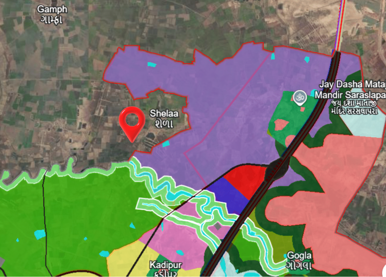
Shela is one of the 18 villages the DSIRDA Draft Development Plan map labels an adjoining village, and it is one of those that genuinely touches the line. Measured from the plan map, roughly 5.75 km of the notified boundary runs along Shela — mid-table among the adjoining villages, well below Kamatalav’s 23.45 km but comparable to Kharad and Rojka.
What makes that figure unusual here is the village’s size. Shela covers only about 594 hectares, so 5.75 km of frontage represents a much larger share of its perimeter than the same figure would in a 4,000-hectare village. In practical terms, relatively little of Shela is far from the boundary.
The frontage is a map-derived estimate rather than a cadastral measurement, so treat it as approximate for any specific parcel. And the distinction that actually decides what you get is unchanged: Shela is outside the notified area. DSIRDA does not plan the roads here, no TP scheme reconstitutes your survey number into a final plot, and infrastructure follows ordinary rural timelines. Touching the boundary does not change that.
Distance Overview
- Dholera SIR boundaryShares boundary (~5.75 km)
- Dhandhuka town~32 km by road
- Ahmedabad~105 km by road
- Post office / PINFedra, 382465
Why People Buy Here
Risks & Considerations
- Shela is outside the notified SIR, so DSIRDA's planned roads, water and power do not apply here — sharing a boundary is not the same as being inside it
- The ~5.75 km frontage is a map-based estimate from the DSIRDA Draft Development Plan, not a cadastral measurement — treat it as approximate for any specific parcel
- At ~594 hectares the village is small, so genuinely large contiguous parcels are limited here
- Older records and seller paperwork may still show Dhandhuka taluka, which makes it easy to pull the wrong extract or approach the wrong office
- Agricultural land can only be bought by a buyer who qualifies under Gujarat's tenancy law — check this before paying an advance
- Search results and listing portals frequently confuse this village with Shela in Ahmedabad West — confirm the census code 511906 on any document before you act on it
Indicative Pricing
Why the difference? Plot rates include NA conversion, internal roads, demarcation and the smaller ticket size. Bulk land is the same land before that work is done.
Price depends on location, road access, connectivity, amenities and several other factors. Indicative as of August 2026. Contact us for current pricing.
Available in Shela
Explore land parcels and plots currently available here.
Frequently Asked Questions
Is this the same Shela as the one near Bopal in Ahmedabad?
Which taluka is Shela village in?
Is Shela inside Dholera SIR?
Why is Shela spelt SELA on the plan map?
What is the land price in Shela village?
Can I build a house on land I buy in Shela?
Where do I check land records for Shela?
Primary References
Primary sources used on this page:
- DSIRDA Draft Development Plan — SIR boundary, adjoining-village labelling, boundary frontage measurement, SELA map spelling
- Census of India 2011 — village code 511906, village area 593.99 hectares, population 1,515 across 256 households
- Panchayat, Rural Housing & Rural Development Department, Government of Gujarat — e-Gram centre list, recording Shela under Dholera taluka, Ahmedabad district
Frontage figures are estimates measured from the plan map, not a cadastral survey. Distances are approximate and for orientation only. DholeraProp is an independent knowledge platform and is not affiliated with DSIRDA, DICDL or the Government of Gujarat.
Our experts are here to help you make the right decision.
Use this checklist before finalising any purchase.
Information on this page is compiled from publicly available government documents and other verified sources. Please verify all details with the relevant authority. Read Full Disclaimer →
Own land in Shela?
DholeraProp deals in land here. If you are considering selling, talk to us about current demand and a fair valuation.